Map of France, ??, Geography and Culture Explained in Detail
Introduction: What Is the Map of France??
The map of France is more than just a cartographic tool—it’s a representation of centuries of history, a mosaic of culture, and a gateway to understanding the nation’s regional diversity. When one studies the map of France, they uncover more than borders or cities—they begin to appreciate how rivers shaped settlements, how mountains formed political boundaries, and how coastal access influenced global influence.
Whether you’re a traveler, student, or someone passionate about European geography, the map of France?? becomes a key element in understanding its identity. This article will break down all the essential elements visible on the map of France, diving deep into its political regions, natural features, and historical context.
The Geographical Structure Seen in the Map of France??
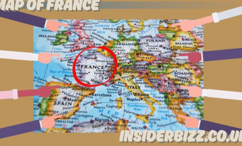
The map of France showcases a hexagonal shape that has earned it the nickname “L’Hexagone.” The country’s territory is defined by natural borders—mountains, rivers, and seas—making it one of the most visually distinguishable nations in Europe.
Key Geographical Features:
- Mountain Ranges:
- The Alps, housing Mont Blanc (highest peak in Western Europe), are visible in southeastern France.
- The Pyrenees serve as the natural border with Spain.
- The Massif Central lies in central France with a rugged volcanic landscape.
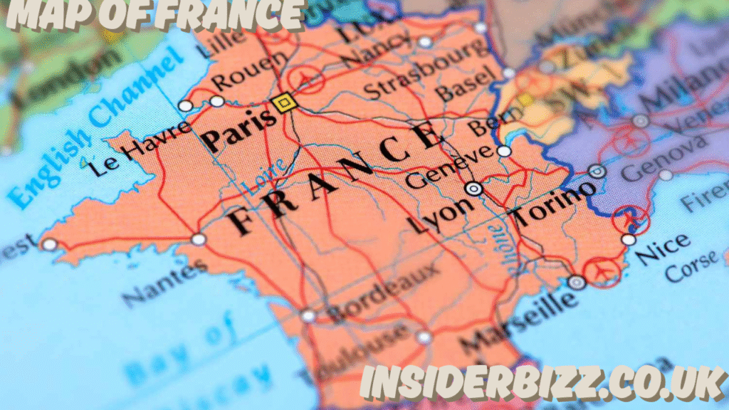
- Rivers:
- The Seine River snakes through Paris and the north.
- The Loire River runs through the picturesque Loire Valley, noted for its châteaux.
- The Rhône flows from Switzerland down to the Mediterranean.
- Coasts and Seas:
- Atlantic Ocean to the west.
- Mediterranean Sea to the southeast.
- English Channel (La Manche) in the north separating it from the UK.
These natural divisions on the map of France?? played a role in shaping cultural and economic divisions throughout the country’s history.
Political Regions on the Map of France??
One major component of the map of France is its division into regions and departments. As of recent administrative restructuring, France consists of 13 metropolitan regions (not including overseas territories).
The 13 Metropolitan Regions Include:
- Île-de-France – Includes Paris, the capital.
- Occitanie – Southwest France, bordering Spain.
- Provence-Alpes-Côte d’Azur – Southeastern France, bordering Italy and the Mediterranean.
- Bretagne (Brittany) – Northwestern coastal region with Celtic roots.
- Normandie (Normandy) – Historic WWII site along the northern coast.
- Nouvelle-Aquitaine – Includes Bordeaux, famous for wine.
- Grand Est – Eastern France, bordering Germany and Switzerland.
- Auvergne-Rhône-Alpes – Includes the Alps and major cities like Lyon.
- Hauts-de-France – Northernmost region.
- Pays de la Loire – Western France, known for castles and agriculture.
- Centre-Val de Loire – Home to the famed Loire Valley.
- Bourgogne-Franche-Comté – Eastern region known for wines and heritage.
- Corsica (Corse) – An island in the Mediterranean, with Italian and French influences.
On the map of France??, each of these regions has distinct cultural traits, dialects, culinary traditions, and economies.
Historic and Cultural Layers of the Map of France??
The map of France is not static—it has evolved through wars, treaties, colonization, and revolutions. Understanding its historical context is vital.
Roman Influence:
The Roman Empire laid early foundations in what is now France, calling it Gaul. Cities like Lyon (Lugdunum) and Paris (Lutetia) grew under Roman planning, leaving roads and aqueducts that influenced the layout still seen on today’s map of France.
The Middle Ages:
Feudal divisions turned France into a patchwork of duchies and kingdoms. The map of France?? from this era looked drastically different, with foreign rulers controlling various segments—like the English ruling parts of Normandy and Aquitaine.
Modern Era:
Following the French Revolution and the Napoleonic era, a more centralized state was formed. The departmental system—still present on the map of France—was created to weaken regional aristocracies and centralize power.
Overseas Territories and Global Reach on the Map of France??
While the focus is often on metropolitan France, the map of France?? also includes overseas regions and departments, often omitted from basic maps.
Notable Overseas Territories:
- Guadeloupe and Martinique – Caribbean islands.
- French Guiana – Located in South America.
- Réunion and Mayotte – Indian Ocean.
- French Polynesia, New Caledonia – Pacific regions.
These are essential parts of modern France and appear in extended versions of the map of France. They have representation in the French parliament and are included in census and economic data.
Map of France and Tourism??
Tourism heavily depends on geography, and the map of France?? helps in understanding why millions flock to the country every year.
Highlights for Tourists:
- Paris (Île-de-France): The Eiffel Tower, Louvre Museum, and Seine River.
- Provence & Côte d’Azur: Mediterranean beaches, lavender fields.
- Loire Valley: Stunning châteaux and wineries.
- Alps: Ski resorts and alpine villages.
- Normandy & Brittany: Rugged coastlines, D-Day beaches, Mont Saint-Michel.
Tourist maps of France often highlight routes, vineyards, UNESCO heritage sites, and rail networks, offering a thematic perspective.
Transportation and Infrastructure Visible on the Map of France??
The map of France?? is also a guide to its impressive transportation infrastructure. The country is interconnected through a dense network of roads, high-speed trains, and airports.
TGV (Train à Grande Vitesse):
France’s high-speed train lines are marked on most modern transport maps, connecting cities like Paris, Lyon, Marseille, and Lille in record time.
Autoroutes:
Major highways like the A1, A6, and A10 radiate from Paris outward, often following Roman or medieval routes.
Airports:
International airports like Charles de Gaulle, Nice, and Lyon-Saint Exupéry are often marked with airplane icons on the map of France.
Economic and Agricultural Zones on the Map of France??
Economic regions differ widely across the map of France?? based on geography.
- Northern France: Once industrial; now transitioning into services and logistics.
- Southwestern France: Agriculture and viticulture dominate.
- Eastern France: High-tech, finance, and energy.
- Mediterranean coast: Tourism and maritime economy.
- Paris region: Global financial and cultural hub.
Maps designed for economic studies show GDP distribution, population density, and agriculture patterns, adding another layer of depth to the standard political map of France.
Educational Importance of the Map of France??
For students and educators, the map of France?? is a fundamental teaching tool. It teaches:
- Basic geography and regional identity.
- National history and the impact of European wars.
- Physical features and how they shaped society.
- The layout of modern France for citizenship and civic studies.
Classroom versions often include blank outlines, topographical overlays, and historical maps, providing multiple educational perspectives.
FAQs About the Map of France??
Q1: Why is France called the “Hexagon”?
A: Because of its roughly six-sided shape as seen on the map, France is often nicknamed “L’Hexagone.”
Q2: How many departments are there in France?
A: France has 101 departments, including overseas departments, all marked on detailed maps.
Q3: What is the difference between a region and a department on the map of France??
A: A region is a larger administrative area containing several departments. Departments are smaller, more localized government zones.
Q4: Are overseas territories shown on all maps of France??
A: No, standard maps may omit them, but official government maps include all overseas territories as part of France.
Q5: What is the most important river on the map of France??
A: The Seine is highly significant due to its passage through Paris, but the Loire is the longest river entirely in France.
Conclusion: Understanding France Through Its Map
The map of France?? isn’t just a representation of land—it’s a tapestry woven with culture, politics, geography, and history. From the snow-capped Alps to the beaches of Normandy, from the capital’s iconic layout to the rural heartlands, everything visible on the map of France tells a deeper story.
Also read : Lucy Whitehouse, ?? – Exploring the Name, the Mystery, and the Identity of Lucy Whitehouse